The Indian River Drive era, 1900-1940: the road that stitched Cocoa to Rockledge to Eau Gallie
Before US-1 and I-95, the Indian River Drive was the lagoon-side road that ran from Titusville south through Cocoa, Rockledge, Eau Gallie, and Melbourne. It defined the mainland Brevard economy for forty years.
The Indian River Drive was the principal mainland road of Brevard County between roughly 1900 and 1940. It ran along the west bank of the Indian River Lagoon from Titusville south through Cocoa, Rockledge, Eau Gallie, and Melbourne, hugging the high ground above the marshes. It was never a single engineered highway. It was a chain of locally-built sections, joined by toll bridges and ferries, that local governments improved piecemeal as the citrus economy and the early tourist trade demanded. When US-1 was built on roughly the same alignment in the 1920s, the Drive’s name faded; the road itself didn’t.
Today’s Rockledge Drive and parts of US-1 through Brevard County run on the original Indian River Drive grade. The Florida Department of Transportation’s mid-century rebuild straightened curves and widened the lanes, but the route is older than the cars on it.
What it was, in 1900
In 1900, “Indian River Drive” meant a sand-and-shell road, occasionally graded, occasionally not, running roughly 70 miles from Titusville to Melbourne. The road existed because the Indian River itself was the principal north-south corridor: steamboats called at every town, freight moved by water, and the road served the houses that fronted the lagoon. It was a residential street as much as a transport corridor.
The grade was built by Brevard County under a series of road-bond issues passed between 1888 and 1910. The county engineer, J.O. Fries (also Florida’s state surveyor and the man who named most of the lagoon’s smaller islands), supervised much of the original alignment. Surface was crushed oyster shell over packed sand, with occasional coquina-block sections through Rockledge where the geology supported it.
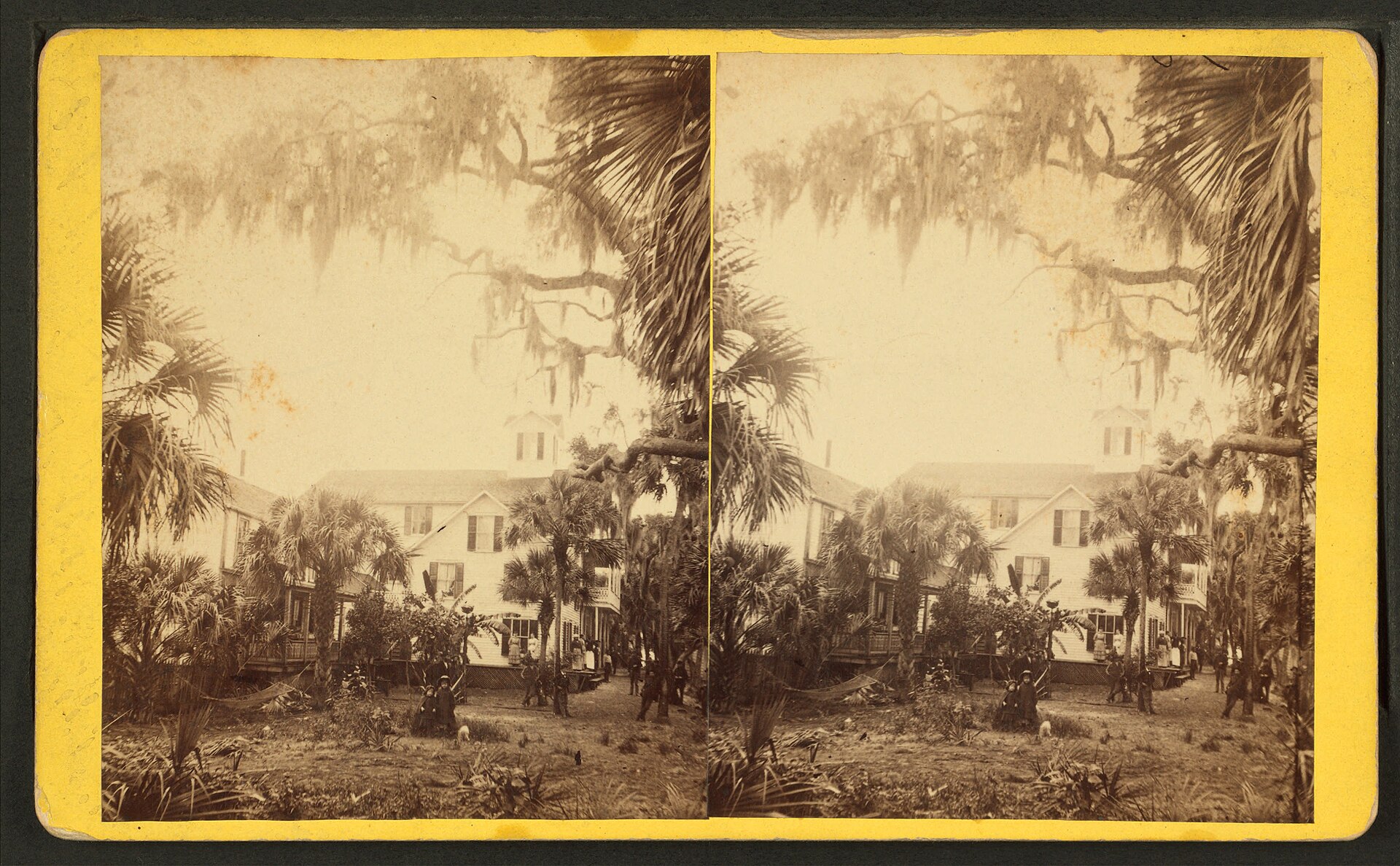
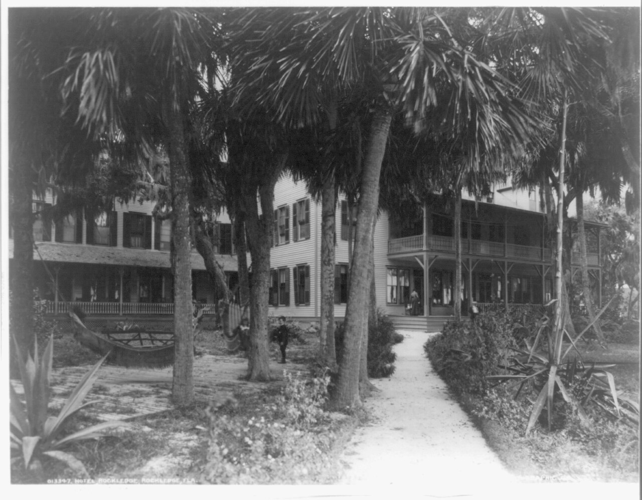
The Drive’s first improvements came in 1905–1910, when Henry Flagler’s Florida East Coast Railway began promoting Florida east-coast tourism in earnest. Flagler’s hotels at St. Augustine, Ormond, and Palm Beach were drawing wealthy Northern winter visitors, and the FEC encouraged county governments to improve roads connecting railroad-stop towns to the lagoon-side estates that Northerners were building. Rockledge in particular became a major winter colony, Hotel Rockledge, the Hotel Indian River, and a string of private mansions made Rockledge briefly more famous than Cocoa.
The Cocoa section
Through Cocoa, the Indian River Drive ran along what is now Brevard Avenue, then curved south on what is now Riverside Drive, hugging the lagoon edge through Rockledge. The Cocoa wharf at the foot of King Street was the steamboat dock and the de-facto town center. Hotels, packing houses, and the original S.F. Travis Hardware building all faced the Drive.
The Cocoa-Rockledge transition is the historically interesting part. Rockledge was incorporated in 1887, five years after Cocoa, and the two towns grew toward each other along the Drive without ever merging (the Cocoa-Rockledge relationship has its own piece). By 1910, the Drive between the two town centers was lined with citrus groves on the west side and lagoon-front estates on the east side. Some of those estates survive today, the most visible is the Hotel Rockledge site, listed on the Library of Congress’s historic photographs.
The bridges and ferries
The Drive ran north-south along the west bank only. To get to the barrier island (where Cocoa Beach now sits, but in 1910 was nothing but scrub palmetto), you took a ferry. The first regular ferry ran from a dock near the foot of King Street in Cocoa across to the spoil islands and then to the barrier island, weather permitting. The crossing took about 45 minutes and cost a quarter for a person, more for a horse and wagon.
The first bridge across the lagoon at Cocoa opened in 1917, a wooden swing bridge linking Cocoa to Merritt Island, with a continuation causeway to the beach. The current Hubert Humphrey Bridge dates to 1971; the predecessor structures are documented in Florida Department of Transportation bridge inventories. The full causeway-and-bridge link to Cocoa Beach didn’t really arrive until the 1925 land-boom era, when developer Gus Edwards needed the barrier island accessible to sell lots.
What the Drive economy looked like
Between 1900 and 1925, the Drive economy was citrus, fish, and winter tourism, in that order.
Citrus moved north on the FEC Railway, which paralleled the Drive about a half-mile to the west of the lagoon. Packing houses lined the rail spurs in Cocoa, Rockledge, and Eau Gallie. The Drive carried the wagons that hauled fruit from grove to packing house. After the 1925 land bust killed most of the speculative subdivisions, the Drive economy collapsed back to citrus and fish, and stayed there until World War II.
Fish meant mullet, mostly, plus sea trout, redfish, and the occasional commercial catch of oysters. The Indian River Lagoon was one of Florida’s most productive estuaries, and Cocoa’s lagoon-front had several commercial fish houses through the 1950s. The combination of post-war agricultural runoff and the 1970s development boom largely ended commercial fishing on the lagoon by 1990, but in 1920 it was a real industry.
Winter tourism meant wealthy Northerners taking the FEC south, then renting houses (or buying lots) along the Drive. Hotel Rockledge, the Plaza Hotel in Cocoa, and the various smaller boarding houses in Eau Gallie hosted what was, by Brevard standards, a substantial winter season, roughly January through April, with peak occupancy in February and March.
What killed the Drive
US-1 killed the Drive as a route name. The federal highway system, designated in 1926, ran north-south along the eastern seaboard, and the Florida section was built largely on top of the existing Indian River Drive alignment between Titusville and Melbourne. By 1935, “US-1” was the universally-used name, and “Indian River Drive” survived only as a local nickname for the surviving spurs that didn’t get widened, most notably the Rockledge section that is still called Rockledge Drive today.
The FEC Railway’s bankruptcy in 1931 and the gradual shift of citrus shipping to trucks over the 1940s and 1950s further reduced the road’s importance. By 1950 it was just another local street.
What survives
You can still drive the original Indian River Drive alignment, more or less, from Titusville south. Take US-1 out of Titusville, branch onto Rockledge Drive at the Cocoa-Rockledge boundary, and pick up the lagoon-front street through Rockledge until it merges back with US-1 near Eau Gallie. Most of the Rockledge mansions from the 1890–1910 winter-colony era are gone, but a handful survive on Rockledge Drive, the Florida Master Site File lists nineteen properties on Rockledge Drive that are individually significant or contributing to the Rockledge Historic District.
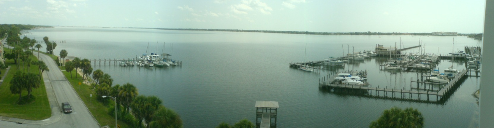
The most photogenic surviving stretch is the Rockledge Drive section between Barton Avenue and Cocoa’s southern boundary. It still looks like a 1910 lagoon-front road. There’s no plaque, no historic-route designation, no signage. Just the road, the lagoon, the oaks, and the houses that survived a century of Florida.
Sources
- Florida Department of Transportation, road history database for State Road 1 / US-1, Brevard County section.
- J.O. Fries, Surveyor’s Notes, Brevard County, 1888–1910, partial transcripts via Florida Memory.
- Brevard County road-bond issuance records, Clerk of Court archives, 1888–1925.
- Florida East Coast Railway annual reports, 1893–1931.
- Cocoa Tribune, transportation coverage, 1908–1940 (microfilm).
- Library of Congress, Historic American Buildings Survey, Hotel Rockledge documentation.
- National Register of Historic Places, Rockledge Historic District nomination.
- Florida Master Site File, Rockledge Drive properties.
- Federal Highway Administration, US Numbered Highway system designation records, 1926.
Further Reading
As an Amazon Associate we earn from qualifying purchases.